An El Niño-driven ocean disturbance could raise Bay Area water levels this fall, increasing flood risk when combined with high tides or storms. For San Mateo bayshore residents, the regional outlook is a reason to monitor local forecasts as seasonal high tides approach.
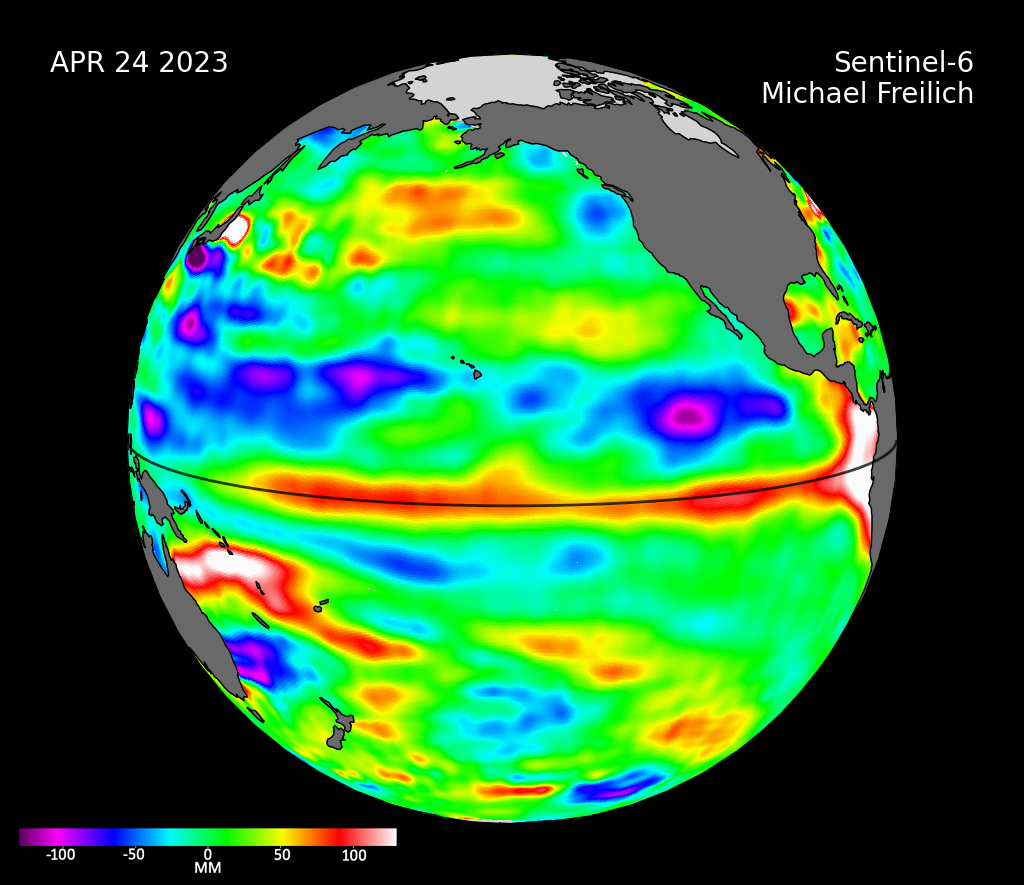
Dillon Amaya, an assistant professor of marine, earth and atmospheric sciences at North Carolina State University, told Patch in an article published Oct. 2 that the Kelvin wave was between Cabo San Lucas and San Diego. Patch reported that it could reach the Bay Area in the second week of October, but Amaya said its position and magnitude were difficult to estimate.
Bay Area sea levels were already about 6 inches above predicted levels because of warm coastal water, KQED reported Oct. 1. Scientists told the outlet the incoming disturbance could raise regional sea levels by up to a foot. The amount and timing at individual locations remain uncertain.
A Kelvin wave is not a breaking wave or a tsunami. It raises the background sea level across a broad stretch of coastline. Ordinary tides, swells and storms then ride on top of that elevated baseline. Amaya told Patch that the wave itself does not cause flooding, but it can increase the risk when those other conditions occur.
The National Weather Service’s Oct. 6 regional forecast identified coastal flood concerns through the weekend because of high tides and water expanding as it warms. The coastal flood advisory checked Oct. 6 covered San Pablo Bay through 1 p.m. Thursday, Oct. 8, rather than San Mateo County.
San Mateo County has already seen what elevated tides can do. In January, king tides exceeding 7 feet combined with an atmospheric river and other conditions to cause record flooding, the county reported. Trails in Millbrae were inundated, and bayside communities including Redwood City and East Palo Alto experienced significant impacts, according to the San Mateo County Sustainability Department. The department’s photo collection also documents high water at Coyote Point in San Mateo.
The wave’s energy has weakened during its northward journey, Amaya told Patch. He said that could put Southern California sea-level increases toward the lower end of a 6-to-12-inch range.
NOAA’s Sept. 10 Climate Prediction Center outlook gives a greater than 90% chance of a very strong El Niño during fall and winter 2026–27. Amaya estimated that Bay Area sea levels might not return to more typical conditions until spring 2027, ABC7 reported Sept. 18.
Gov. Gavin Newsom declared a state of emergency on Sept. 21, directing preparations for potential El Niño impacts, including flooding and coastal hazards. The announcement calls for staging road-closure equipment and preparing the California National Guard to support response efforts when needed.
California’s statewide king tide dates are Nov. 24–26 and Dec. 23–25, 2026, and Jan. 21–22, 2027, according to the California Coastal Commission. Some Northern California locations have additional dates; residents should check the commission’s tide map for local times.
The San Mateo County Flood and Sea Level Rise Resiliency District, known as OneShoreline, plans and builds projects to address flooding, sea-level rise and coastal erosion. Residents near the bayshore can monitor forecasts and advisories through the NWS Bay Area office and sign up for SMC Alert, the county’s emergency notification system.